Silk Road Buddhist cultural atlas database
Silk Road Buddhist cultural atlas database
Feature:
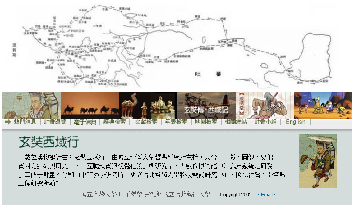
This database consists of two projects, namely “The World of Xuanzang and the Silk Road” and “Silk Road: Spatiotemporal Platform of Sino-India Cultural Exchange”
“Digital Museum — The World of Xuanzang and Silk Road” contains research articles, dictionaries, historical materials of art & image, as well as content from A Record of the Tang`s Western Regions and Journey to the West. “Silk Road: Spatiotemporal Platform of Sino-India Cultural Exchange” offers spatiotemporal interactive maps to visualise interactions among person, event, time, location and object, it is a platform for Silk Road studies and researches.
About:
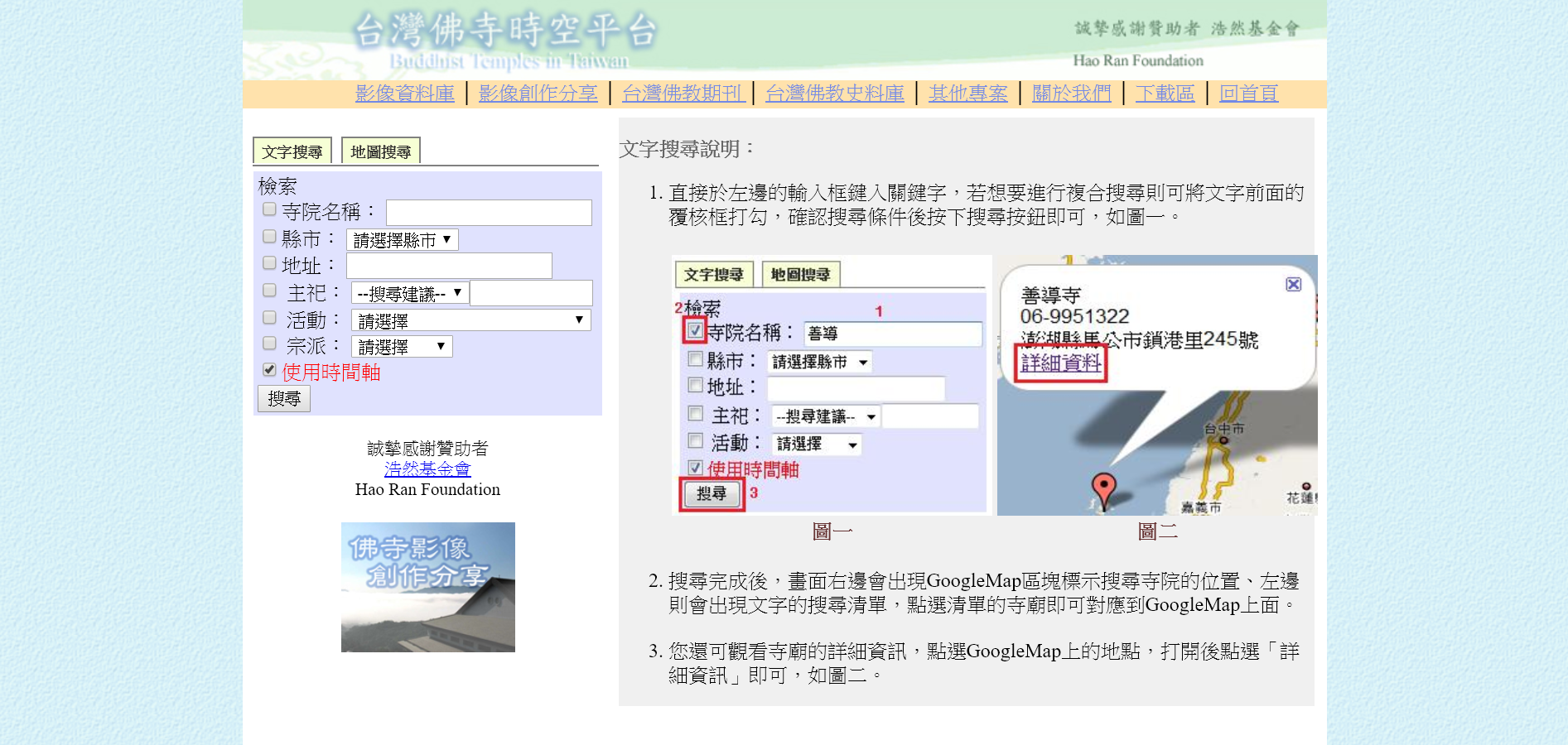
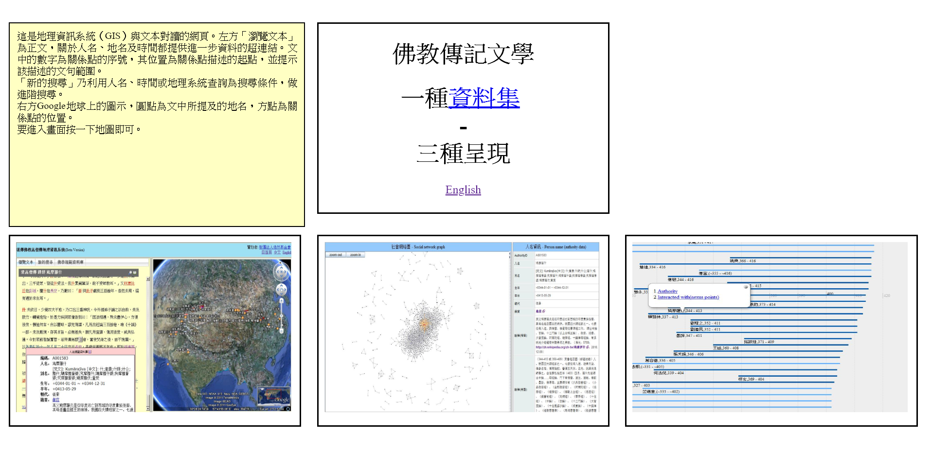
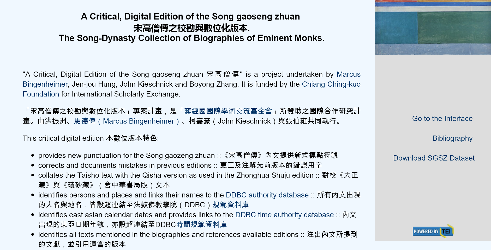
The “Silk Road: Spatiotemporal Platform of Sino-India Cultural Exchange” features Event Orientated Route, TimeMap, Literature, Research, and Investigation Database etc. The spatiotemporal aspects of historical events and results of textual studies are presented through interactive Google Map and TimeLine. Furthermore, Buddhist literatures, history of Chinese Buddhism and geographical features of the Silk Road are integrated in the interface which consists of maps, photos & videos, indexes and related texts. These three-dimensional time-space visual representations have satellite-positioned those land and sea pilgrimage routes which were traced by Chinese monks travelling westward and foreign monks coming into China, including “Westward Pilgrimage Routes of Three Masters, 2011”, “Western Regions Pilgrimage Route of 61Masters, 2012”, “Spatiotemporal Database of the Record of Travel to the Tang in Search of the Dharma (Nyūtō guhō junrai kōki),2014”, “Spatiotemporal Database of the Biographies of Five Japanese Monks who Went to Tang, 2015”. The objective of this project is to create an online platform with comprehensive pictures on Silk Road and Buddhist culture.